28. October 2015 · Comments Off on Rainy Wednesday Continues · Categories: Fall, precipitation, weather discussion · Tags: , ,

12187645_1161776330518621_8307118838897616032_n

Everything is on track for us to receive a good soaking today. It will not be raining all the time. The rain will come in waves, be heavy at times then nothing or only a drizzle.

There will also be gusty winds today in western New Jersey. The biggest threat will be the combination of rain + falling leaves = very slipper travel in sports. If you have ever walked on a bunch of wet leaves you know how slippery they can be. This is the first significant rain, with wind, and leaves we’ve had this fall so be on look out.

The storm could produce a band of heavy rain and wind in the middle of the night. There could also be some rumbles of thunder.

Warmer weather will continue today into tomorrow until a colder push of weather arrives later Thursday then cool into Saturday. Trick or treating continues to be fair but chilly on Saturday.

27. October 2015 · Comments Off on Drenching Rain On Wednesday · Categories: Fall · Tags: , ,

Cover_0

Get out an enjoy another nice weather day on Tuesday. Today should be similar to yesterday with the exception of some increasing clouds. The rain should hold off until after midnight tonight. Then we should see rain on an off for close to 24 hours starting early Wednesday morning lasting until the pre dawn hours on Thursday. Winds will be gusty as well on Wednesday. Good news is we need the rain and temperatures on Wednesday will be on the warm side.

If you do have any outdoor Halloween decorations you might want to secure them.

Western New Jersey will receive from 1-2″ of rain from this event. There’s even an outside chance there could be a rumble or two of thunder later in the day on Wednesday! Colder more seasonable air will arrive on Thursday and last into the weekend. At this time trick-or-treating looks dry and chilly.

25. October 2015 · Comments Off on Improving Conditions Sunday Afternoon · Categories: Fall · Tags: , ,

20151023_081017

A cold front is pushing through western New Jersey Sunday and will result in improving conditions this afternoon. There will be increasing amounts of sunshine and conditions will start to dry out. We only received about 1/10th of an inch of rain. More on the way Wednesday.

Fall colors are peaking in western New Jersey so get outside and enjoy them before you have to rake ’em!

7day

Monday and tuesday will be much more seasonable with high temperatures a few degrees below normal. Our next rain will be on Wednesday in to Thursday morning. This could be a good soaking of much needed rain as the remnants of Hurricane Patricia pass to our west. More details as we get closer.

09. October 2015 · Comments Off on Tornado Warning in SE PA · Categories: thunderstorms · Tags: , , ,

Radar20151009-1648

While not in western New Jersey still impressive to see in October! Chester and Montgomery counties in PA under tornado warning now.

09. October 2015 · Comments Off on Showers On the Way: Update · Categories: Fall · Tags: , , ,


Radar20151009-1525

As of 3:30, rain and some thundershowers is moving in from the NW. Keep an eye to the sky for the next few hours.

Radar20151009-1048

A cold front will be approaching the area later today. Some pre-frontal showers have already popped up and should be entering western New Jersey within the next hour.

After that we should have a little break then more activity later this afternoon. Don’t be surprised if you even hear a rumble of thunder! Yes it’s October but it does happen occasionally. Look for the afternoon showers to start as early as 2 pm but hopefully should be clear of the area in time for Friday night HS football!

03. October 2015 · Comments Off on Saturday Morning Update · Categories: Fall · Tags: ,

sfcmap

Overnight western New Jersey picked up about another 1″ of new rainfall. That brings our 4 day total to 2.5-3″ of rain in the area. The rain was much needed and thankfully didn’t all come down at once.

Looks for the unseasonably cool and damp weather to continue today. Highs will only be in the low 50’s with scattered showers. Nothing should be a wash out but there will be some drizzle and showers at times. And the cloudy skies and north east wind will make it feel cooler than it really is.

Conditions should improve Sunday as hurricane Joaquin passes out to sea. Coastal flooding will continue to be an issue near the shore into early next week.

Speaking of next week, we should see the return of party sunny skies with high temperatures in the upper 60’s and low 70’s.

02. October 2015 · Comments Off on Friday Night Rain Update · Categories: Fall · Tags: ,

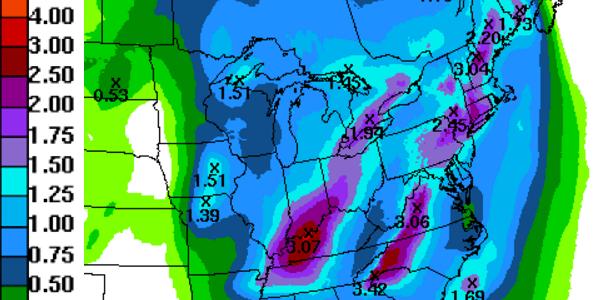
There’s still plenty (of rainfall) ahead for tonight:

northeast (1)

Hopefully you don’t have outdoor plans. If you do, dress accordingly. Its not only raining, but its chilly! Temperatures in western New Jersey are in the upper 40’s! This is more like November than October.

Western New Jersey has it much better than southern section of the state. Here’s a summary of rain and wind so far:

********************storm total rainfall********************

Location          storm total     time/date   comments                   
                     rainfall           of 
                     /inches/   measurement

Delaware

...Kent County...
   Frederica             2.79  1256 PM 10/02  deos                    
   Adamsville            2.74   112 PM 10/02  deos                    
   Dover                 2.67   112 PM 10/02  deos                    
   Woodside              2.60   116 PM 10/02  deos                    
   Harrington            2.54   116 PM 10/02  deos                    
   Kitts Hummock         2.36   116 PM 10/02  deos                    

...Sussex County...
   Nassau                4.45   112 PM 10/02  deos                    
   Long Neck             4.20  1251 PM 10/02  deos                    
   Rehoboth Beach        3.75   112 PM 10/02  deos                    
   Bethany Beach         3.49  1251 PM 10/02  deos                    
   Harbeson              3.47  1251 PM 10/02  deos                    
   Lewes                 3.43  1241 PM 10/02  deos                    
   Selbyville            3.28  1241 PM 10/02  deos                    
   Stockley              2.64   112 PM 10/02  deos                    
   Gumboro               2.61   112 PM 10/02  deos                    
   Bridgeville           2.48   116 PM 10/02  deos                    
   Ellendale             2.37   245 PM 10/02  deos                    
   Laurel                2.30   245 PM 10/02  deos                    
   Georgetown            2.22   245 PM 10/02  deos                    

Maryland

...Caroline County...
   Federalsburg          2.40   205 PM 10/02  co-op observer          

New Jersey

...Burlington County...
   Mount Holly WFO       1.66   158 PM 10/02  NWS office              

...Cumberland County...
   Greenwich             2.50   307 PM 10/02  mesonet                 


**********************24 hour rainfall**********************

Location              24 hour     time/date   comments                   
                     rainfall           of 
                     /inches/   measurement

Delaware

...Kent County...
   2 W Milford           2.01   830 am 10/02  cocorahs                
   2 ENE Harrington      1.59   808 am 10/02  cocorahs                
   9 E Hazlettville      1.54   758 am 10/02  AWOS                    

...Sussex County...
   7 ENE Dagsboro        3.73   700 am 10/02  cocorahs                
   1 NW Ocean View       3.50  1000 am 10/02  cocorahs                
   7 E Selbyville        2.91   700 am 10/02  cocorahs                
   2 SSW Lewes           2.75   700 am 10/02  cocorahs                
   1 S Seaford           2.55   700 am 10/02  cocorahs                
   4 E Delmar            2.49   700 am 10/02  cocorahs                
   6 W Georgetown        2.48   800 am 10/02  cocorahs                
   2 SSE Seaford         2.45   700 am 10/02  cocorahs                
   S Dewey Beach         2.45   800 am 10/02  cocorahs                
   1 W Millsboro         2.44   730 am 10/02  cocorahs                
   4 SW Lewes            2.40   615 am 10/02  cocorahs                
   1 SW Seaford          2.39   700 am 10/02  cocorahs                
   4 SSE Milton          1.97   700 am 10/02  cocorahs                
   Sussex County airpor  1.86   754 am 10/02  ASOS                    
   3 S Milford           1.78   700 am 10/02  cocorahs                
   1 NNW Ellendale       1.61   700 am 10/02  cocorahs                

Maryland

...Caroline County...
   1 ENE Greensboro      1.52   700 am 10/02  cocorahs                

...Talbot County...
   4 NE Trappe           2.80   800 am 10/02  cocorahs                
   NNE Bellevue          2.07   800 am 10/02  cocorahs                
   2 se Easton           1.82   700 am 10/02  cocorahs                
   1 E Easton            1.68   700 am 10/02  cocorahs                

New Jersey

...Atlantic County...
   4 SW Egg Harbor City  1.78   820 am 10/02  cocorahs                
   3 NNE Buena Vista tw  1.56   756 am 10/02  cocorahs                
   1 NW Egg Harbor TWP   1.55   700 am 10/02  cocorahs                

...Cape May County...
   WSW Wildwood Crest    1.61   750 am 10/02  cocorahs                
   3 se upper TWP        1.54   800 am 10/02  cocorahs                

...Cumberland County...
   2 E Upper Deerfield   1.68   700 am 10/02  cocorahs                


***********************peak wind gust***********************

Location             Max wind     time/date   comments                   
                        gust            of 
                         mph    measurement

Delaware

...Anz431...
   Brandywine Shoal nos    48   630 am 10/02  nos platform            

...Sussex County...
   18 se Big Stone beac    45   136 am 10/02  nwlon                   
   Rehoboth Beach          42   254 PM 10/02  weather flow            

New Jersey

...Anz451...
   Long Beach island       47   320 am 10/02  weather flow            
   Kite Island Barnegat    46  1230 PM 10/02  weather flow            

...Atlantic County...
   Atlantic City Intl a    40  1138 am 10/02  ASOS                    
   8 S New Gretna          40   425 am 10/02  RAWS                    

...Cape May County...
   Ocean City              47  1258 PM 10/02  weather flow            
   19 ESE Port Norris      45   201 am 10/02  cwop                    
   Cape May County airp    40   655 am 10/02  AWOS                    

...Monmouth County...
   Sands Point             42  1205 am 10/02  weather flow            
   29 SSE Tottenville      42  1000 am 10/02  NJ-mesonet              
   Sandy Hook              41   210 PM 10/02  weather flow            

...Ocean County...
   little Sheepshead CR    54   124 PM 10/02  weather flow            
   Tuckerton               52   257 PM 10/02  weather flow            
   Seaside Heights         48   555 am 10/02  weather flow            
   10 ESE Bass River St    48   210 am 10/02  cwop                    
   15 ENE Bass River St    47  1255 PM 10/02  safetynet               
   18 ENE Bass River St    45  1230 PM 10/02  USGS                    
   South Seaside Park      45  1207 PM 10/02  weather flow            
   North Beach Haven       44  1012 am 10/02  weather flow            
   15 ENE Penn state fo    42   608 am 10/02  cwop                    
   brick TWP               40   805 am 10/02  weather flow            
   Surf City               40   511 am 10/02  weather flow
02. October 2015 · Comments Off on Moderate Rain On the Way · Categories: Fall · Tags: ,

Radar20151002-1333

Radar show an area of moderate rain (green) moving north towards western New Jersey. Look for rain to start picking up in the next hour or two.

02. October 2015 · Comments Off on Friday Morning Joaquin Update · Categories: Hurricane · Tags: ,

115432W_sm

Overnight models continue to support the idea of hurricane Joaquin heading to the north and east and not directly impacting the US coast. There of course will be indirect effects.

12107076_1149187978444123_7260283343702031871_n

Rain will move back into western New Jersey this morning and remain on and off through the night. Showers should be the rule for both Saturday and Sunday. Heavier rain now looks to remain to our south with our area receiving between 1/2″ and 1″ of rain – perhaps a bit less to the north.

And let’s not forget about the wind. I already had a gust to 19 this morning and the day just begun!

7day

Post Joaquin we get into some nice fall weather.

Updates as warranted.

01. October 2015 · Comments Off on September 2015 Monthly Summary for Stewartsville · Categories: Monthly Summary · Tags: ,
Stewartsville Monthly Weather Observation Summary
Sep-15
DAY MAX MIN MEAN PRECIP COMMENTS
1 87 66 76.5 0.00
2 90 63 76.5 0.00
3 91 64 77.5 0.00
4 88 67 77.5 0.00
5 85 64 74.5 0.00
6 84 56 70.0 0.00
7 91 56 73.5 0.00
8 94 64 79.0 0.00
9 93 70 81.5 0.16
10 75 66 70.5 1.28
11 82 62 72.0 0.00
12 74 57 65.5 0.93
13 71 54 62.5 0.01
14 74 52 63.0 0.00
15 82 51 66.5 0.00
16 85 53 69.0 0.00
17 85 54 69.5 0.00
18 85 54 69.5 0.00
19 82 56 69.0 0.00
20 77 54 65.5 0.00
21 73 49 61.0 0.00
22 71 55 63.0 0.00
23 79 48 63.5 0.00
24 82 47 64.5 0.00
25 76 55 65.5 0.00
26 74 53 63.5 0.00
27 71 49 60.0 0.00
28 80 62 71.0 0.00
29 82 68 75.0 0.33
30 77 60 68.5 1.38
4.09
Extreme High 94.0 Date: 8-Sep
Extreme Low 47.0 Date: 24-Sep
Mean Max: 81.3
Mean Low: 57.6
Mean: 69.5
dabour@att.net
Day>=90 5
Day>=85 11
Plugin for Social Media by Acurax Wordpress Design Studio
Visit Us On TwitterVisit Us On FacebookVisit Us On PinterestVisit Us On YoutubeVisit Us On Instagram