


Dangerous cold continues today into the weekend. High temperatures will be in the teens and overnight lows in the single digits near zero, if not below zero later in the week.


As we look and temperature trends into February, both the 6-10 day and 8-14 day temperature outlook are below normal. It could be worse – you could be vacationing in Florida this weekend as they will have extensive freeze warnings down there.

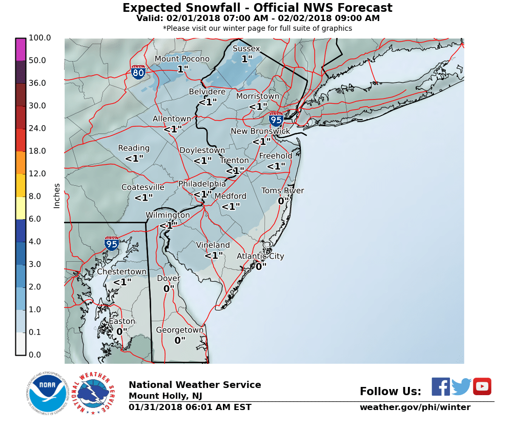
As we turn our attention to the weekend and beyond, there will be a strong storm that will form south of us. That is a given. The big question is how far north it will travel or will it mostly go out into the Atlantic. As seen in the above graphic, the NWS is leaning towards the next storm staying mostly to our east. But also note that it has hazardous cold from 1/30-2/1. Brrr.


Recent Comments