
Clouds to the south and east Monday morning
Western New Jersey is in between weather systems on Monday. A weak system running up the east coast was giving us some clouds to the east this morning but they have pushed further to the east as of late morning. We should see a good amount of sunshine today but more clouds will start to increase from the south and west later on for our next system for tomorrow.

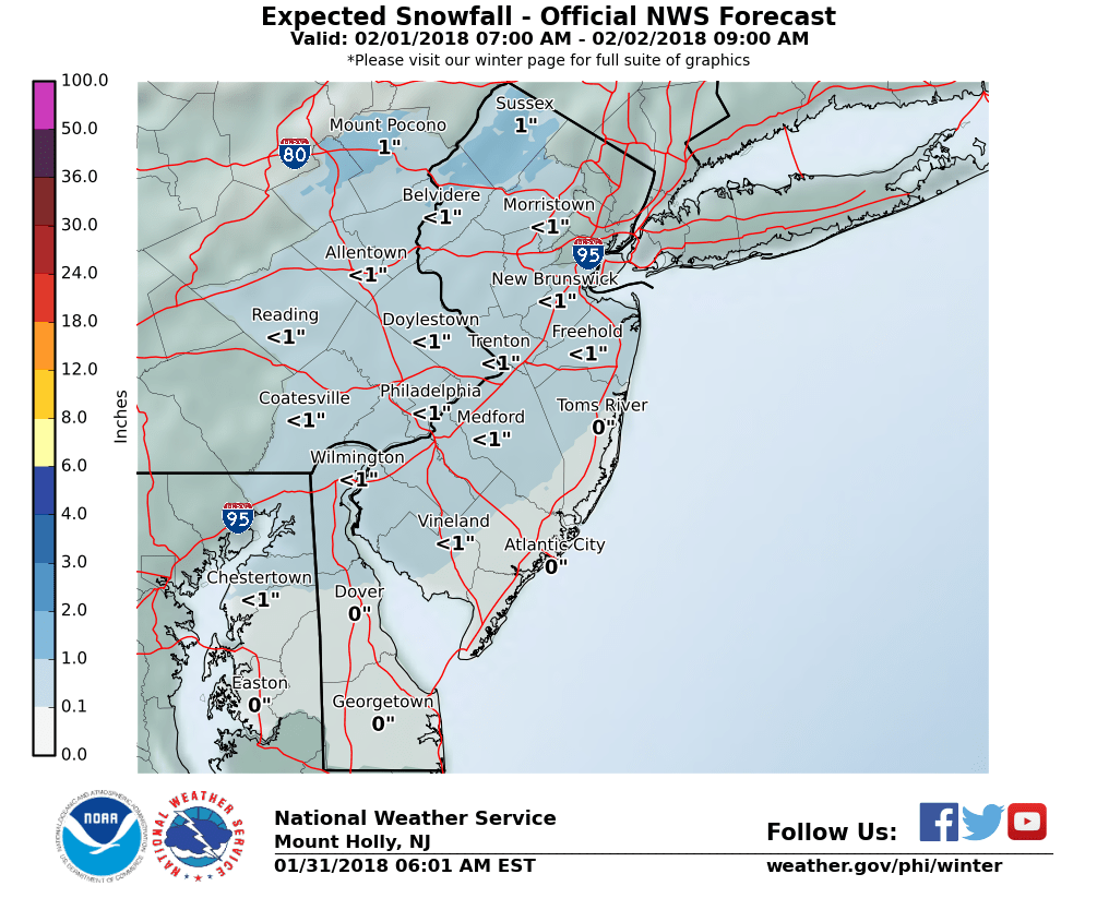
NWS Snow Forecast for Tuesday
Tomorrow we will see a weakening system approaching western New Jersey from the west and south as it tries to transfer some of it’s energy to the east. This system does not look very impressive. The big question is will the snow arrive before the morning rush. As of right now there are no weather advisories, watches or warnings in the area. Most of the snow appears to stay to our west tomorrow. This system reminds me of the last system when snowed over PA most of the day as it inched closer to NJ.
The snow does look intermittent and light for Tuesday. As of right now my forecast is for a coating to 1″
The rest of the week looks cooler then we turn our attention to a rain chance late Thursday into Friday morning that can end as snow. Then will there be snow on super Sunday?


Recent Comments