24. October 2016 · Comments Off on Freeze Watch For Wednesday Morning · Categories: Fall · Tags:
Last October in western New Jersey. Photo by Dave Dabour

Last October in western New Jersey. Photo by Dave Dabour

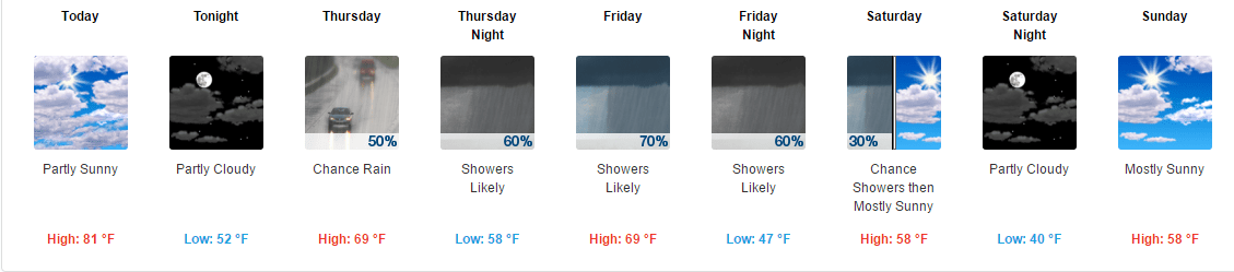
Well this week it will finally feel like late October. It’s been looking like late October, just not feeling like it.

We have a freeze watch in effect for late Tuesday night and early Wednesday morning. If there’s anything growing outside that you care about, last call.

...Freeze watch in effect from late Tuesday night through
Wednesday morning...

The National Weather Service in Mount Holly has issued a freeze
watch...which is in effect from late Tuesday night through Wednesday
morning.

* Locations...much of eastern Pennsylvania, portions of New Jersey
  into parts of both northeast Maryland and far northern Delaware.
  This freeze watch does not include the urban centers near
  Philadelphia.

* Temperatures...lows are expected to range within several degrees
  of 30 early Wednesday morning over the Countryside. Frost or
  freezing temperatures are forecast within the watch area. 

* Timing...coldest temperatures should occur between 6 am and 730
  am Wednesday, with frost or freezing temperatures possibly
  beginning as early as midnight in the normally colder sheltered
  valleys. 

* Impacts...the upcoming seasonably cold frost or freeze event
  will probably end the growing season in parts of this area,
  especially near and north of Interstate 78 inclusive of the
  Lehigh Valley. If and when warnings or advisories are issued,
  protective action should be considered for sensitive outdoor
  plants.

Precautionary/preparedness actions...

A freeze watch means sub-freezing temperatures are possible.
These conditions could kill crops and other sensitive vegetation.
19. October 2016 · Comments Off on How Long Will July In October Last? · Categories: Fall · Tags:

20161016_081004

I hope everyone that enjoys warmer weather is taking advantage of this crazy July in October weather. To put this in perspective, our overnight lows are what our daytime highs should be!!

7day

We should be able to turn off the A/C tonight as overnight lows will fall into the still above normal lower 50’s. By this weekend the warm temperatures will only be a distant memory as we struggle to get out of the 50’s for daytime highs!

13. October 2016 · Comments Off on Hurricane Nicole Hits Bermuda · Categories: Fall, Hurricane · Tags:
Bermuda Webcam View Thursday Morning

Bermuda Webcam View Thursday Morning

Yes that is a picture above even though it looks like fog. There are some trees to the right along the edge and some more to the middle right.

Hurricane Nicole is bearing down on the island nation this morning. Overnight Nicole had strengthened to a category 4. Luckily it has weaken slightly to a cat 3.

The good new, if there is any for Bermuda, is Nicole appears to pass just to the east of the island. The right side of a hurricane is the strongest so hopefully this will help minimize damage. But its close enough that some part of the island may be impacted by the western edge of the eye wall.

10. October 2016 · Comments Off on Frost Advisory Tonight · Categories: Fall · Tags:

650x366_10091620_hd26-1

The first frost advisory of the fall is underway for many sections of western new jersey tonight. Today’s breezy conditions will give way to calm winds tonight. That coupled with clear skies will allow nighttime temperatures to drop to the mid to upper 30’s. This will result in scattered frost.

Further to the north, there’s even a chance of the first freeze of the season as temperatures will get close to the 32 mark.

URGENT - WEATHER MESSAGE
NATIONAL WEATHER SERVICE MOUNT HOLLY NJ
329 AM EDT MON OCT 10 2016

NJZ001-007>009-PAZ054-055-060>062-101-103-105-102100-
/O.NEW.KPHI.FR.Y.0009.161011T0600Z-161011T1300Z/
SUSSEX-WARREN-MORRIS-HUNTERDON-CARBON-MONROE-BERKS-LEHIGH-
NORTHAMPTON-WESTERN CHESTER-WESTERN MONTGOMERY-UPPER BUCKS-
INCLUDING THE CITIES OF...NEWTON...WASHINGTON...MORRISTOWN...
FLEMINGTON...JIM THORPE...STROUDSBURG...READING...ALLENTOWN...
BETHLEHEM...EASTON...HONEY BROOK...OXFORD...COLLEGEVILLE...
POTTSTOWN...CHALFONT...PERKASIE
329 AM EDT MON OCT 10 2016

...FROST ADVISORY IN EFFECT FROM 2 AM TO 9 AM EDT TUESDAY...

THE NATIONAL WEATHER SERVICE IN MOUNT HOLLY HAS ISSUED A FROST
ADVISORY...WHICH IS IN EFFECT FROM 2 AM TO 9 AM EDT TUESDAY.

* TEMPERATURES...IN THE MID 30S.

* TIMING...LATE MONDAY NIGHT INTO TUESDAY MORNING.

* IMPACTS...SENSITIVE PLANTS MAY BE SUSCEPTIBLE TO DAMAGE.

PRECAUTIONARY/PREPAREDNESS ACTIONS...

A FROST ADVISORY MEANS THAT WIDESPREAD FROST IS EXPECTED.
SENSITIVE OUTDOOR PLANTS MAY BE KILLED IF LEFT UNCOVERED.
07. October 2016 · Comments Off on Hurricane Matthew Weakens Slightly And Stays Offshore · Categories: Fall, Hurricane · Tags: ,

145747w_sm

So far it looks like things could have been a lot worse. My motto is prepare for the worse and hope for the best.

Based on recent reconnaissance flights into the hurricane, the maximum winds found were lower than 120 mph. But the NHC decided to maintain the major category strength. There is some good physiological logic in doing so. If the media starts advertising a weakening hurricane, people will be more likely to lower their guard and start doing unsafe things.

So far the highest wind gust on land I saw was just over 100 mph at Cape Canaveral. It was measured on a sensing station that was 50 meters in the air which is higher than the normal 10 meters that wind is typically measured.

Warnings have been discontinued for southern 1/3 of the state.

Later today and tomorrow the fun heads north to Georgia and South Carolina coasts. Even as the storm continues to weaken, it will still have damaging winds and drenching rains and storm surge flooding.

06. October 2016 · Comments Off on Major Hurricane Matthew Strengthens · Categories: Fall, Hurricane · Tags:

145747w_sm

The 11 am update on major hurricane Matthew has it back at a category 4 major hurricane. This is not surprising since it’s been over the very warm waters in the Bahamas. Satellite imagery showed the storm becoming better organized after moving through the land masses of Haiti and Cuba.

Tropical storm watch and warnings are now along the west coast of Florida. Yes the winds will be tropical storm strength even on the other side of Florida! Tropical storm winds start at 39 mph and hurricane starts at 74.

The crazy thing about this storm is the future track. It could loop around and impact Florida a second time! If it does so it will be much weaker then but still it will not be good.

05. October 2016 · Comments Off on Latest on Matthew: Good for North, Bad for South · Categories: Fall, Hurricane · Tags:

145747w_sm

Matthew has weakened slightly and is now a category 3. This was expecting since it was interacting with land masses.

Hurricane warnings are now up for parts of the Florida coast. Hurricane watches have been extended further north.

The latest forecast track has Matthew tracking close to the eastern Florida coast.

There has been a trend for the last 12 hours that is now taking the hurricane out to sea once it gets up to North Carolina. This is good news for the mid-Atlantic and the Northeast US. This is something that still needs to be watched carefully and tracked. We will still see some rain later Saturday into Sunday morning. This will be from the approaching cold front and at this time does not appear to link up with Matthew.

04. October 2016 · Comments Off on Tuesday Afternoon Hurricane Matthew Update · Categories: Fall, Hurricane · Tags:

145747w_sm

As of 2 pm today, major Hurricane Matthew is through Haiti now with eastern Cuba in it’s sights. The storm is still a category 4 with 145 sustained winds with higher gusts. Still moving north but expected to start a more NW turn later on.

14l_tracks_latest

You can see from the map above, the NHC keeps Matthew east of us. That is good news. I suspect Matthew will start interacting with the approaching cold front. If that happens, we should receive health amounts of rain and wind later on Saturday into Sunday morning.

There are currently Hurricane watches up for the east coast of Florida. The Governors of FL and North Carolina have already declared state of emergencies. I also just read that mandatory evacuations have been ordered for along the immediate coast of South Carolina.

Look for Hurricane Watches to be extended further north as time goes on and even Watches into Warnings.

After Cuba, the Bahamas will be impacted Wednesday. Then Florida on Thursday, especially afternoon on.


04. October 2016 · Comments Off on Major Hurricane Matthew Makes Landfall On Haiti · Categories: Fall, Hurricane · Tags:

14606511_1200805219963062_6466437877171226555_n

Matthew is the strongest storm on earth for the moment. The people of Haiti are still recuperating from their devastating earthquake not too long ago. Prayers to anyone in it’s path.

03. October 2016 · Comments Off on Stewartsville September 2016 Monthly Summary · Categories: Monthly Summary · Tags:
Stewartsville Monthly Weather Observation Summary
Sep-16
DAY MAX MIN MEAN PRECIP COMMENTS
1 82 63 72.5 0.10
2 81 57 69.0 0.00
3 79 57 68.0 0.00
4 82 53 67.5 0.00
5 87 54 70.5 0.00
6 87 66 76.5 0.00
7 89 66 77.5 0.00
8 93 65 79.0 0.00
9 92 73 82.5 0.00
10 96 71 83.5 0.00
11 83 60 71.5 0.00
12 81 50 65.5 0.00
13 85 56 70.5 0.00
14 91 60 75.5 0.00
15 76 53 64.5 0.00
16 78 47 62.5 0.00
17 82 50 66.0 0.00
18 85 67 76.0 0.00
19 76 66 71.0 1.35
20 83 64 73.5 0.00
21 85 59 72.0 0.00
22 86 53 69.5 0.00
23 88 50 69.0 0.00
24 74 51 62.5 0.00
25 73 43 58.0 0.00
26 71 41 56.0 0.00
27 75 52 63.5 0.33
28 71 46 58.5 0.00
29 62 55 58.5 0.45
30 61 52 56.5 1.12
3.35
Extreme High 96.0 Date: 10-Sep
Extreme Low 41.0 Date: 26-Sep
Mean Max: 81.1
Mean Low: 56.7
Mean: 68.9
Plugin for Social Media by Acurax Wordpress Design Studio
Visit Us On TwitterVisit Us On FacebookVisit Us On PinterestVisit Us On YoutubeVisit Us On Instagram