29. December 2015 · Comments Off on Sleet Summary · Categories: winter · Tags: , ,

20151229_082025

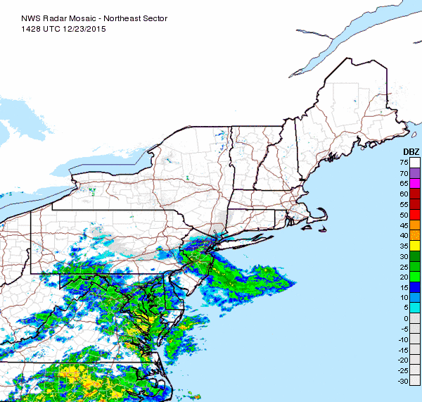
Many a backyard deck in western New Jersey probably looked like this early this morning. Sleet from last evening and overnight did accumulate on some colder surfaces. In extreme northern New Jersey there was some snow mixed in as well. Wantage reported 1.0″ and Rockaway reported 1/2″

Here are some additional reports:

PUBLIC INFORMATION STATEMENT
SPOTTER REPORTS
NATIONAL WEATHER SERVICE MOUNT HOLLY NJ
542 AM EST TUE DEC 29 2015

THE FOLLOWING ARE UNOFFICIAL OBSERVATIONS TAKEN DURING THE PAST 7
HOURS FOR THE WEATHER SYSTEM THAT HAS BEEN AFFECTING OUR REGION.
APPRECIATION IS EXTENDED TO COOPERATIVE OBSERVERS...SKYWARN SPOTTERS
AND THE GENERAL PUBLIC FOR THESE REPORTS. THIS SUMMARY IS ALSO
AVAILABLE ON OUR HOME PAGE AT WEATHER.GOV/PHI

********************STORM TOTAL SNOWFALL********************

LOCATION          STORM TOTAL     TIME/DATE   COMMENTS
                     SNOWFALL           OF
                     /INCHES/   MEASUREMENT

NEW JERSEY

...MORRIS COUNTY...
   MARCELLA               0.3  1210 AM 12/29  TRAINED SPOTTER
   GREEN POND             0.3  1130 PM 12/28  SLEET AND SNOW.

...SUSSEX COUNTY...
   WANTAGE                1.2   515 AM 12/29  SNOW AND SLEET.
   4 SW WANTAGE           0.6   450 AM 12/29  SNOW AND SLEET.

PENNSYLVANIA

...CARBON COUNTY...
   LEHIGHTON              1.1   535 AM 12/29  SNOW AND SLEET.

Temperatures are now above freezing in most of western New Jersey. rain will finish by mid day.

And here are some more. Stewartsville received 1/10″ of sleet:

The following are unofficial observations taken during the past 11
hours for the weather system that has been affecting our region.
Appreciation is extended to Highway departments...cooperative
observers...Skywarn spotters and media for these reports. This
summary is also available on our home Page at weather.Gov/phi

********************storm total snowfall********************

Location          storm total     time/date   comments                   
                     snowfall           of 
                     /inches/   measurement

New Jersey

...Burlington County...
   Burlington               T   245 PM 12/28  rain and sleet mix      

...Hunterdon County...
   Tewksbury TWP          0.9   726 am 12/29  1000 foot elevation     
   2 ENE Clinton          0.1   700 am 12/29  cocorahs                
   Flemington               T   356 PM 12/28  rain and sleet mix      

...Mercer County...
   Princeton                T   320 PM 12/28  rain and sleet mix      

...Middlesex County...
   Monroe TWP               T   319 PM 12/28  rain and sleet mix      

...Morris County...
   1 W Randolph TWP       0.5   713 am 12/29  cocorahs                
   NNW Rockaway           0.4   800 am 12/29  cocorahs                
   2 SW Randolph TWP      0.4   800 am 12/29  cocorahs                
   Green Pond             0.3  1130 PM 12/28  sleet and snow.         
   Marcella               0.3  1210 am 12/29  trained spotter         

...Somerset County...
   1 NNW Bernards TWP     0.2   730 am 12/29  cocorahs                
   1 ENE Bernards TWP     0.1   700 am 12/29  cocorahs                

...Sussex County...
   Wantage                1.2   515 am 12/29  snow and sleet.         
   2 SW Wantage TWP       0.8   700 am 12/29  cocorahs                
   3 WNW Montague TWP     0.8   700 am 12/29  cocorahs                
   4 SW Wantage           0.6   450 am 12/29  snow and sleet.         
   3 se Hardyston TWP     0.5   800 am 12/29  cocorahs                
   2 se Wantage TWP       0.5   610 am 12/29  cocorahs                

...Warren County...
   Delaware               0.5   800 am 12/29  social media            
   1 W Hackettstown       0.1   700 am 12/29  cocorahs                

Pennsylvania

...Berks County...
   Wyomissing               T   105 PM 12/28  social media            

...Bucks County...
   Doylestown               T   249 PM 12/28  rain and sleet mix      

...Carbon County...
   Lehighton              1.1   535 am 12/29  snow and sleet.         

...Lehigh County...
   Lehigh Valley Intl a     T   100 am 12/29  ASOS                    
   Heidelberg TWP           T   300 PM 12/28  rain and sleet mix      
   Vera Cruz                T   321 PM 12/28  trained spotter         

...Monroe County...
   5 W Stroudsburg        0.8   800 am 12/29  cocorahs                
   Mount Pocono           0.8   807 am 12/29  trained spotter         
   Canadensis             0.8   910 am 12/29  snow and sleet          
   Pocono Summit          0.6   910 am 12/29  snow and sleet          
   7 NE east stroudsbur   0.5   900 am 12/29  cocorahs                

...Northampton County...
   Bangor                 0.6   910 am 12/29  sleet                   
   Martins Creek          0.3   910 am 12/29  sleet                   
   E Martins Creek        0.2   700 am 12/29  cocorahs                

...Philadelphia County...
   Philadelphia             T   214 PM 12/28  rain and sleet mix      


***********************storm total ice***********************

Location          storm total     time/date   comments                   
                          ice           of 
                     /inches/   measurement

New Jersey

...Morris County...
   2 ESE Denville TWP    0.01   700 am 12/29  cocorahs                

...Sussex County...
   Sussex Airport        0.05   800 am 12/29  kfwn ASOS               
   2 SW Wantage TWP         T   700 am 12/29  cocorahs                
   High Point               T   705 PM 12/28  trained spotter         

Pennsylvania

...Monroe County...
   Pocono Mountains air  0.13   753 am 12/29  ASOS                    
   5 W Stroudsburg          T   800 am 12/29  cocorahs
28. December 2015 · Comments Off on Wintry weather overnight · Categories: winter · Tags: , , , ,

StormTotalSnowWeb1

The National Weather Service (NWS) has continued their winter weather advisory for tonight into early Tuesday morning. I’m expecting precipitation to break out over western New Jersey this evening from 7 pm – 10 pm. It could start out as a cold rain in some areas. Then the rain will cool the atmosphere a little more and the rain should mix if and possibly change to sleet for a few hours. Further to the north and west (near and north of I-80), especially in elevated areas, there could be some wet snow mixed in as well.

Warmer air will eventually take over and we should see all rain by the Tuesday morning commute. The changeover will take a bit longer further to the north and west. Given how warm the ground has been recently I expect little of any accumulation. At most there could be a little slush on colder surfaces like cars.

The most important thing to keep an eye on tonight is the air temperature. As long as we remain above freezing the roads and walkways should be fine. Bit some areas further to the north and west, as well as sheltered valleys, may have pockets of colder temperatures. In these areas we might see a little bit of freezing rain after the switch-over until the warmer temperatures make it to those areas as well.

I’ll have additional updates as warranted.

27. December 2015 · Comments Off on Winter Weather Advisory for Monday evening · Categories: winter · Tags: , ,

The NWS has issued a Winter Weather advisory for Monday evening for western New Jersey (northers and western sections – currently does not include Hunterdon). I’ll post my thoughts on this tomorrow morning.

URGENT - WINTER WEATHER MESSAGE
NATIONAL WEATHER SERVICE MOUNT HOLLY NJ
323 PM EST SUN DEC 27 2015


NJZ007-008-PAZ061-062-280945-
/O.NEW.KPHI.WW.Y.0023.151229T0000Z-151229T1200Z/
WARREN-MORRIS-LEHIGH-NORTHAMPTON-
INCLUDING THE CITIES OF...WASHINGTON...MORRISTOWN...ALLENTOWN...
BETHLEHEM...EASTON
323 PM EST SUN DEC 27 2015

...WINTER WEATHER ADVISORY IN EFFECT FROM 7 PM MONDAY TO 7 AM EST
TUESDAY...

THE NATIONAL WEATHER SERVICE IN MOUNT HOLLY HAS ISSUED A WINTER
WEATHER ADVISORY FOR SLEET FREEZING RAIN AND SNOW...WHICH IS IN
EFFECT FROM 7 PM MONDAY TO 7 AM EST TUESDAY.

* LOCATIONS...PORTIONS OF THE LEHIGH VALLEY INTO NORTHWEST NEW
  JERSEY NEAR INTERSTATE 80.

* HAZARD TYPES...SLEET...FREEZING RAIN AND SNOW.

* ACCUMULATIONS...SNOW AND SLEET ACCUMULATION OF UP TO 1
  INCH...ALONG WITH AROUND A TRACE OF ICE.

* TIMING...MIXED PRECIPITATION BEGINS SOMETIME BETWEEN 7 PM AND
  11 PM MONDAY AND MAY BRIEFLY CHANGE TO ALL SNOW OR SLEET AROUND
  MIDNIGHT BEFORE CHANGING TO FREEZING RAIN AND THEN RAIN BETWEEN
  5 AM AND 7 AM TUESDAY.

* WINDS...NORTHEAST 5 TO 15 MPH WITH GUSTS UP TO 20 MPH.

* TEMPERATURES...FALLING TO BETWEEN 30 AND 32 DEGREES FOR A TIME
  MONDAY NIGHT BEFORE RISING ABOVE FREEZING AROUND DAYBREAK
  TUESDAY.

PRECAUTIONARY/PREPAREDNESS ACTIONS...

A WINTER WEATHER ADVISORY MEANS THAT PERIODS OF SNOW...SLEET...OR
FREEZING RAIN WILL CAUSE TRAVEL DIFFICULTIES. BE PREPARED FOR
SLIPPERY ROADS AND LIMITED VISIBILITIES...AND USE CAUTION WHILE
DRIVING.

SNOWFALL AND ICE ACCUMULATION FORECAST MAPS IN ADDITION TO
EXPERIMENTAL PROBABILISTIC SNOWFALL INFORMATION FOR THE LATEST
EVENT ARE AVAILABLE ONLINE AT WWW.WEATHER.GOV/PHI/WINTER

&&
25. December 2015 · Comments Off on Merry Christmas! Wintry weather on the way? · Categories: weather discussion, weather forecast, winter · Tags:

Fb Holidays

First and foremost Merry Christmas for all who celebrate! The weather in western New Jersey is certainly not very Christmas like with fog this morning and afternoon high temperatures to be in the mid 60’s!

7day

But we all knew the warm weather would have to come to an end sooner or later. Remember normal high temperatures for this time of year are in the upper 30’s!!

There will be some showers on and off from tonight into Sunday night. Monday morning looks rain free but then a storm system will be approaching our area Monday night into Tuesday. Enough cold air will start flowing into the area on Monday to give us high temperatures near normal. Monday night will feature a cold rain that will mix with sleet, especially in colder areas to the north and west and possibly mix with if not change to snow for a while. This all continues into Tuesday morning but warmer air will be arriving and should change us over to rain but mid day if not sooner. I don’t expect much if any in the way of accumulation at this point since the ground is still soo warm.

I’ll post updates on this as we approach. I just wanted to give a heads up wince there is a lot of family travel this time of year.

23. December 2015 · Comments Off on Fog, More rain Then Warmth · Categories: weather discussion, winter · Tags: , ,

20151223_084358

It’s quite foggy in some section of western New Jersey this Wednesday morning. Not good for anyone with last minute shopping to finish. PLease take your time.

northeast_loop (1)

More rain is on the way for this afternoon into the first part of this evening.

10177359_1190637494299171_5586683321780895374_n

I expect western New Jersey to receive anywhere from 1/2″ to 1″ of rain.

Then just in time for Christmas Eve, warm temperatures!

If I don’t get a chance to post again until after Christmas I want to wish all readers a Merry Christmas and Happy Holidays! Thank you for reading my thought on weather for our area.

22. December 2015 · Comments Off on Ready For A Florida Christmas? · Categories: weather discussion, winter · Tags: ,

1422586_1012600658796743_4076395658852590876_n

If you ever wondered what Christmas would be like in Florida, you may get your wish this year. Residents of western New Jersey will experience record breaking temperatures this Christmas eve and high’s could approach the low 70’s! So get out the shorts and fire up the grill for Christmas! Let’s just hope we’re not shoveling snow on Memorial Day to make up for all the unusually mild weather…

21. December 2015 · Comments Off on Happy Winter Solstice · Categories: weather discussion, winter · Tags: , ,

12391990_1189651677731086_6822728934333297134_n

Even though it doesn’t feel like it in western New Jersey (or the entire east coast for that matter), today marks the beginning of winter. The weather this week will be anything but winter-like. Record high temperatures appear to be in the forecast for Christmas Eve. From this point on we will (slowly at first) start having more sunlight.

7day

We will see more clouds this week and rain Tuesday morning. Rain chances should decrease as Christmas Eve approaches.

16. December 2015 · Comments Off on Warning: seasonable weather ahead! · Categories: weather discussion, weather forecast, winter · Tags: ,
7 day weather forecast for western new jersey

colder weather ahead

Today should be the last of the nice and warm days for a while for western New Jersey. Even thought it felt closer to the season as you head out the door today, high temperatures will still be above normal in the low 50’s.

Another rain maker is on the way for Thursday. this system looks to bring more rain than the last. We should see around 1/3″ to 1/2″ of rain.

After the rain it turns colder. But nothing crazy for the second half of December. But it will feel very cold since we’re all used to the above normal temperatures! But don’t worry too much – the long rang outlook for next week has us back in the 50’s and possibly approaching 60 again. Hopefully Santa knows how to land without snow 😎

06. December 2015 · Comments Off on Icy Fog This Morning · Categories: weather discussion, weather forecast, winter · Tags: ,
Icy fog covers western new jersey this Sunday morning. Photo by DAVE DABOUR

Icy fog covers western new jersey this Sunday morning. Photo by DAVE DABOUR

Icy fog will greet you this Sunday morning in western New Jersey. Fog forms on clear calm night. Plus temperatures are in the mid 20’s so the fog will freeze on some surfaces so be careful early this morning until it warms up!

This afternoon will turn into a nice day with sunny skies and temps in the mid 50’s


02. December 2015 · Comments Off on Stewartsville November 2015 Summary · Categories: Monthly Summary · Tags: , ,
Stewartsville Monthly Weather Observation Summary
Nov-15
DAY MAX MIN MEAN Heating Degree Day PRECIP SNOW SOG COMMENTS
1 66 45 55.5 10 0
2 64 43 53.5 12 0
3 74 38 56.0 9 0
4 76 42 59.0 6 0
5 69 51 60.0 5 0
6 75 63 69.0 -4 0
7 70 48 59.0 6 0
8 58 35 46.5 19 0
9 61 29 45.0 20 0
10 58 50 54.0 11 0.41
11 63 49 56.0 9 0.04
12 58 45 51.5 14 0.08
13 56 44 50.0 15 0
14 50 37 43.5 22 0
15 59 32 45.5 20 0
16 68 39 53.5 12 0
17 53 34 43.5 22 0
18 60 33 46.5 19 0
19 63 56 59.5 6 1.24
20 62 32 47.0 18 0.00
21 52 30 41.0 24 0.00
22 50 35 42.5 23 0.00
23 41 23 32.0 33 0.00
24 47 22 34.5 31 0.00
25 52 25 38.5 27 0.00
26 61 29 45.0 20 0.00
27 66 34 50.0 15 0.00
28 58 45 51.5 14 0.00
29 50 32 41.0 24 0.00
30 46 24 35.0 30 0.02
485 1.79 0.00
Extreme High 76.0 Date: 4-Nov
Extreme Low 22.0 Date: 24-Nov
Mean Max: 59.5
Mean Low: 38.1
Mean: 48.8
Plugin for Social Media by Acurax Wordpress Design Studio
Visit Us On TwitterVisit Us On FacebookVisit Us On PinterestVisit Us On YoutubeVisit Us On Instagram