
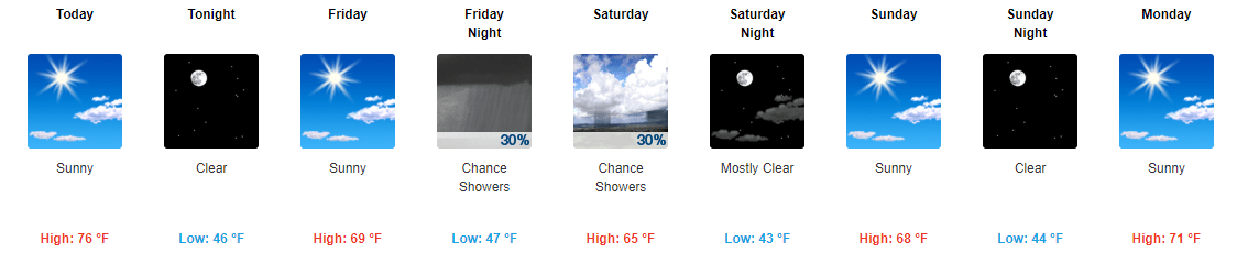
7 Day forecast for western New Jersey
The early fall heat wave is over! Much more seasonable and enjoyable weather is finally here. Or back if you remember the early part of the month! Some warmer and above normal weather looks to return around the middle of next week but ti doesn’t look to be as warm as what we just had – hopefully only mid 70’s for daytime highs.

8-14 day precipitation forecast

8-14 day temperature forecast
In looking ahead to the first half of October for western Jersey, warm and dry trend of late looks to continue. My lawn is starting to show signs of dryness – first time this warm season!
HOpefully we will still have cool nights. Fall foliage likes warm days and cool nights to bring out the best and brightest colors!


Recent Comments