05. September 2022 · Comments Off on Flood Watch Into Tuesday · Categories: weather discussion · Tags: , , ,
Much needed rain on the way

Even though parts of our area received rain on August 23rd, that was nearly 2 weeks ago!

Expected rainfall tonight into Tuesday

Even though our Labor Day weather is featuring filtered sunshine this morning, look for clouds to increase an lower with increasing showers as the day wears on. The rainiest period will be overnight into Tuesday morning

25. February 2020 · Comments Off on Spring-Time Weather Gone For Now · Categories: weather discussion · Tags: , , ,

Hopefully, everyone got a chance to get outside and enjoy our spring preview weather the past couple of days. I for one got outside and rode my bicycle for the first time this year.

Even though today will be cooler, it will still be above normal temperature-wise. Look for occasional rain today which should be less than 1/4″ total.

The rain will let up on Wednesday during the day but skies should remain cloudy and conditions will be damp. A second system will approach our area Wednesday overnight that will give us ore substantial rain. This will be the next step down in temperatures to several days of below normal temperatures

Strong gusty winds will accompany the colder temperatures Wednesday night into Thursday. Look for the potential of some scattered power outages along with tree damage.

Look for colder than normal temperatures with high temperatures in the 30’s for late week into the weekend. Or normal high temperatures now are in the low 40’s so we will end our warm month on a cooler note.

Not a fan of the colder windy weather? Don’t worry like most of this past winter it won’t last for more than a few days. Extended weather forecasts have us warming up quite nicely by the middle of next week!

Will there be any more snow this winter? Let’s just say nothing significant in the next 2 weeks. the graphic above shows the probabilities of receiving 3″ or more of snow now through March 11th. Ironically there could be some snow flurries or snow showers Thursday and Friday with the delivery of the colder temperatures but they shouldn’t amount to much in our area.

27. October 2019 · Comments Off on Soggy Sunday · Categories: Fall · Tags:

Sorry for the lack of posts lately. I’ve been swamped with my photography business working 7 days a week.

Moderate to occasionally heavy rain has overspread western New Jersey and will continue until early to mid-afternoon. Look for rain totals to be 1-2″. As of 10 am Stewartsville has received just over 1/2″

After today’s rain pulls out above normal temperatures should be around for most of this upcoming week. Monday and Wednesday look to be the picks of the week. Tuesday will have some clouds and a chance of some drizzle and showers.

Then our attention turns to Halloween. Another storm similar to today looks to impact our region with some rain. The good news is it looks to continue to be near to slightly above normal temperatures.

After that, we look to enter a cool period with temperature below normal for several days into next weekend and the first part of the following week.

19. March 2019 · Comments Off on Spring Arrives on Wednesday · Categories: spring, weather discussion · Tags: ,

Spring officially arrives on Wednesday late afternoon/evening at 5:58 pm.

The first partial day of Spring 2019 will be a nice one with high temperatures in the low 50’s. Normal high temperature this time of year is 50.

Unfortunately the first full day of spring doesn’t look as nice. In fact it looks to repeat weather that we’ve been seeing a lot of since last year: more rain. A cold front will pass through our area. A storm will form on the southern end of the cold front and move on up to the north east. At first it looked like this storm would mostly stay to the east of our area. Now we may be close enough to it to feel the impact of rain and wind. The worst of it will be to our east. So Thursday is looking like a rainy day with perhaps 2/3 to perhaps 3/4″ or more of rainfall. Friday into Saturday will be cooler and windy. Sunday looks to be the better half of the weekend and kick off spring in a nice way!

24. September 2018 · Comments Off on Brief Return To Summer with Rain and Thunder · Categories: Fall, thunderstorms · Tags: ,

Total rain forecast thru Wednesday

Our taste of fall and some dry weather takes a break on Tuesday and especially Wednesday. A soaking rain is on the way overnight into early Tuesday morning. MOst areas of western New Jersey look to receive 1-1.50″ of rain. The steadiest rain should be later Monday night into Tuesday morning. Then the rain should become more showery and intermittent.

SPC Wednesday Outlook

Then much warmer and unstable air move in on Wednesday before a cold front move thru later at night and brinks back the cooler temperatures. The SPC has placed our entire area in a slight risk of severe weather Wednesday. Right now the afternoon and evening looks to be the time frame.

22. August 2018 · Comments Off on Overnight Rain · Categories: weather discussion · Tags: , ,
Near 1.5″ of rain falls in Stewartsville overnight

Another 1.50″ plus has fallen overnight in the western New Jersey area – certainly nothing out of the ordinary of recent times. With the ground still being saturated, water puddles up quickly and floods swollen streams and rivers.

Today a cold front will push through the area and usher in cooler and dryer weather. This could be accompanied by a few scattered showers and perhaps even a thundershower.

Then get ready to crack open the windows at night with several nights low temperatures in the 50’s!

Fear not if your a summer lover. Warm and humid weather will start to return on Sunday and continue into the new week. This could continue into Labor Day weekend and perhaps beyond…

11. August 2018 · Comments Off on Another Soggy Weekend · Categories: flood watch, Summer · Tags: , , , ,

Flash Flood Watch

Most sections of western New Jersey saw and heard a good amount of rain and thunderstorms in the wee hours of this morning. Stewartsville received 1.04″ of new rain as of 7:30 am today. More rain has fallen since then. All of this rain has resulted in a Flash Flood Watch for the entire area.

NE Radar Loop

As of mid-day the good news is most of the heavier rain has moved thru extreme western New Jersey and will be out of all of northern NJ soon. As you can see in the radar loop above there appears to be a break in the precipitation. How long will it last? I suspect we will see rain returning by mid to late afternoon.

Weather Outlook this weekend

Our overall forecast from 8 am this morning until Sunday morning is more heavy rains possible with flash flooding possible.

1-2 Day Precip Total forecast

The above map shows extreme western New Jersey forecast to receive about another 1.50″ of rain from Saturday morning until Monday morning. Sections further to the east could be closer to 2″

31. July 2018 · Comments Off on Increasing Rain and Humidity On the Way · Categories: flood watch, thunderstorms · Tags: ,

SPC severe weather outlook for Wednesday

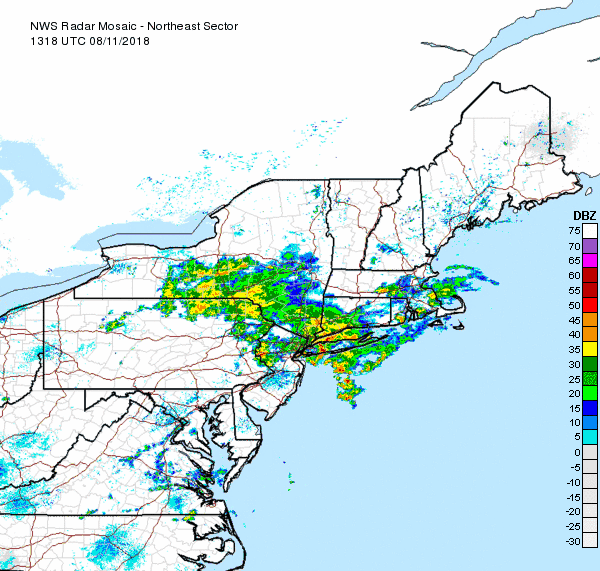
I’ve mentioned in previous posts that we will be seeing more humidity and rain this week. So far it has held off. There were some sprinkles yesterday with some heavier rain in isolated sports to out south.

Wednesday looks to increase the chances of more rain and humidity. In the map above, the SPC has place EPA and extreme western New Jersey in a slight risk for severe weather. Some of the computer models are suggesting a line of thunderstorms tomorrow evening around 9 pm or so. We’ll keep an eye on these storms tomorrow.

Excessive rain outlook for Wednesday

As seen in the above map, there is a slight chance of rainfall reaching flash flood guidance Wednesday in central PA – exactly the place that doesn’t need more rain!

Excessive rain outlook for Thursday

Unfortunately it doesn’t get any better on Thursday. As seen in the map above that area shifts closer and even touches western New Jersey

1-5 day rain total

1-3 day rain total

As seen in the above maps, we have the potential to receive 1 to perhaps 3″ of rain in the next several days. We can thank the moist pattern we are once again in bringing humid air from the tropics right into out own backyeards

16. May 2018 · Comments Off on Wet Weather Replaces Wild Tuesday · Categories: spring · Tags: , , ,

5 Day NWS forecast

After a wild Tuesday weather-wise, we are much calmer, cooler and wetter today. Many locations yesterday reported strong wind gusts (46 in Stewartsville), heavy rain (0.42″ in Stewartsville), hail (1/4″ report in Stewartsville) and more. There was even a tornado warning to our west in eastern PA. There were also other tornado warnings in the region. One was just confirmed in Putnam county.

Today’s showers will continue on and off. Tomorrow we should get a little bit of a break but there is a threat of more rain on Friday. There is some disagreement on how far north the rain will come on Friday. If it gets into western New Jersey, we will easily see an additional 1-2″ of rain. If it stays to our south, less.

12. January 2018 · Comments Off on More Rain Tonight Then Crashing Down Temperatures · Categories: weather discussion, winter · Tags: , ,

Radar showing another area of rain to move into western New Jersey

Radar showing another area of rain to move into western New Jersey

Just about 1″ of rain has fallen in Stewartsville so far today. As seen in the radar image above another area of rain is about to move into western New Jersey. This should be somewhat lighter than what we received before.

Look to the far left on that map and you see pink and blue representing mixed precipitation and snow. Yes that’s right while it’s in the low 60’s here, it’s snowing in the far NW part of PA.

NWS Ice Forecast for Saturday AM

NWS Ice Forecast for Saturday AM

Th cold air should arrive in western New Jersey very fast between 1 am and 5 am tomorrow morning. If it’s still raining we could see that change over to some sleet or freezing rain. As such the NWS has issued a winter weather advisory for Warren county and further N&W. The threat should be over by mid morning tomorrow then sharply colder temperatures over the weekend into next week.

Next change of some wintry weather will be on Tuesday and Wednesday. More on that as it approaches.

Floating Social Media Icons by Acurax Wordpress Designers
Visit Us On TwitterVisit Us On FacebookVisit Us On PinterestVisit Us On YoutubeVisit Us On Instagram