25. November 2018 · Comments Off on Impressive Rain Totals Overnight Saturday · Categories: Fall, flood watch · Tags:

Rain totals from overnight

There’s an old saying “when it rains, it pours” and that was certainly true last night. Another round of impressive overproducing rainfall that we don’t need in western New Jersey. 2.32″ was recorded in Stewartsville. Look at the map above to see some other reports.

How much did you record?

Sunday is a very pleasant day we all desperately need to not only dry out but to do any needed outdoor activities. Holiday lights might be a good idea!

More rain returns for Monday afternoon. Right now it “only” looks like another 1/2 to 3/4 of an inch. Cooler weather returns for the balance of the week after the rain

Areal flood watches remain in effect for certain streams

27. September 2018 · Comments Off on Flood Watch Tonight into Friday Morning · Categories: Fall, flood watch · Tags:

Flood Watch

Boy when it rains it pours around here. Stewartsville only received 0.06″ of rain yesterday at my station but I was attending a meeting on the other end of town and I could hear the rain pounding down on the roof. Not sure how much fell there but LVI airport was under the same cell and received 0.65″ of rain.

A wave of low pressure has formed on the cold front that pushed through last night as was responsible for all the rain. Look for a chance of shower later today and this evening. The steadiest and heaviest rain will be overnight into Friday morning. We are only expecting about 1/2″ of new rain but with the ground being so saturated it won’t take much to cause problems in some areas hence the Flood Watch.

Friday afternoon the weather will greatly improve. We should be OK for Friday NIght Lights and a b-e-a-utiful Fall weekend!

…FLOOD WATCH IN EFFECT FROM THIS EVENING THROUGH LATE TONIGHT…

The National Weather Service in Mount Holly has issued a

* Flood Watch for portions of eastern Pennsylvania, portions of northern, central and southwestern New Jersey, northern Delaware, and northeastern Maryland.

* From this evening through late tonight.

* An area of heavy rain is forecast to lift northeastward across the region tonight. Rainfall totals up to an inch or two are expected with some locally higher amounts possible.

* The heaviest of the rain is expected to fall over only a few hours. As a result, localized flooding is anticipated on roadways and in areas of poor drainage. Small streams and creeks are already running high and some minor flooding may occur.

PRECAUTIONARY/PREPAREDNESS ACTIONS…

A Flood Watch means there is the potential for flooding based on the current forecast.

If you live in a location that is prone to flooding, please monitor the forecast through the day and be alert for possible Flood Warnings tonight.

11. August 2018 · Comments Off on Another Soggy Weekend · Categories: flood watch, Summer · Tags: , , , ,

Flash Flood Watch

Most sections of western New Jersey saw and heard a good amount of rain and thunderstorms in the wee hours of this morning. Stewartsville received 1.04″ of new rain as of 7:30 am today. More rain has fallen since then. All of this rain has resulted in a Flash Flood Watch for the entire area.

NE Radar Loop

As of mid-day the good news is most of the heavier rain has moved thru extreme western New Jersey and will be out of all of northern NJ soon. As you can see in the radar loop above there appears to be a break in the precipitation. How long will it last? I suspect we will see rain returning by mid to late afternoon.

Weather Outlook this weekend

Our overall forecast from 8 am this morning until Sunday morning is more heavy rains possible with flash flooding possible.

1-2 Day Precip Total forecast

The above map shows extreme western New Jersey forecast to receive about another 1.50″ of rain from Saturday morning until Monday morning. Sections further to the east could be closer to 2″

31. July 2018 · Comments Off on Increasing Rain and Humidity On the Way · Categories: flood watch, thunderstorms · Tags: ,

SPC severe weather outlook for Wednesday

I’ve mentioned in previous posts that we will be seeing more humidity and rain this week. So far it has held off. There were some sprinkles yesterday with some heavier rain in isolated sports to out south.

Wednesday looks to increase the chances of more rain and humidity. In the map above, the SPC has place EPA and extreme western New Jersey in a slight risk for severe weather. Some of the computer models are suggesting a line of thunderstorms tomorrow evening around 9 pm or so. We’ll keep an eye on these storms tomorrow.

Excessive rain outlook for Wednesday

As seen in the above map, there is a slight chance of rainfall reaching flash flood guidance Wednesday in central PA – exactly the place that doesn’t need more rain!

Excessive rain outlook for Thursday

Unfortunately it doesn’t get any better on Thursday. As seen in the map above that area shifts closer and even touches western New Jersey

1-5 day rain total

1-3 day rain total

As seen in the above maps, we have the potential to receive 1 to perhaps 3″ of rain in the next several days. We can thank the moist pattern we are once again in bringing humid air from the tropics right into out own backyeards

18. May 2018 · Comments Off on Flood Watch Discontinued; Rain Still On the Way · Categories: flood watch · Tags:

16. May 2018 · Comments Off on Flood Watch Friday · Categories: flood watch · Tags: ,

Flood Watch

335 PM EDT Wed May 16 2018

...FLOOD WATCH IN EFFECT FROM THURSDAY EVENING THROUGH LATE
FRIDAY NIGHT...

The National Weather Service in Mount Holly has issued a

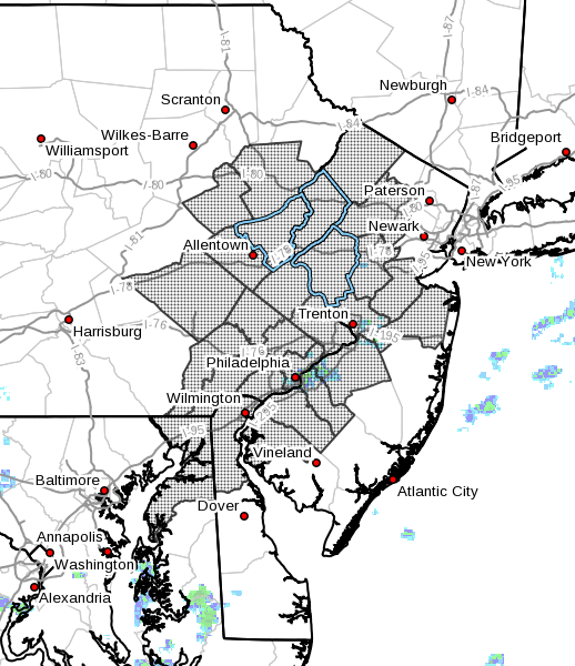
* Flood Watch for portions of Delaware, northeast Maryland, New
  Jersey, and Pennsylvania, including the following areas, in
  Delaware, Delaware Beaches, Inland Sussex, Kent, and New
  Castle. In northeast Maryland, Caroline, Cecil, Kent MD, Queen
  Annes, and Talbot. In New Jersey, Atlantic, Atlantic Coastal
  Cape May, Camden, Cape May, Coastal Atlantic, Coastal Ocean,
  Cumberland, Eastern Monmouth, Gloucester, Hunterdon, Mercer,
  Middlesex, Northwestern Burlington, Ocean, Salem, Somerset,
  Southeastern Burlington, Warren, and Western Monmouth. In
  Pennsylvania, Berks, Delaware, Eastern Chester, Eastern
  Montgomery, Lehigh, Lower Bucks, Northampton, Philadelphia,
  Upper Bucks, Western Chester, and Western Montgomery.

* From Thursday evening through late Friday night

* Periods of light to moderate rain will continue this afternoon
  through tomorrow. A brief break in the rain is expected early
  tomorrow evening before it once again intensifies and becomes more
  widespread tomorrow night. Periods of moderate to heavy rain are
  then expected to persist into at least Friday, possibly into the
  weekend. General rainfall amounts of 2 to 4 inches are expected
  the next 72 hours with the highest totals along and south of the
  Interstate 78 corridor. Locally higher amounts are possible across
  the same area as thunderstorms are expected to periodically
  develop.

* A variety of flooding types are all possible within the Flood
  Watch area. First, low-lying and poor drainage flooding is the
  most likely type of flooding to develop. Second, flash flooding
  will be possible under the stronger thunderstorms. Flash
  flooding occurs quicker than other types flooding due to the
  torrential rain thunderstorms can produce in a short amount of
  time. Flash flooding is most likely to occur across urban areas
  where rainfall runoff is maximized and where small creeks and
  streams respond quickly. The rain has to go somewhere and
  eventually leads to larger streams and rivers. This is where the
  third type of flooding is possible. If you live across the
  Passaic, Raritan, and Rancocas basins in New Jersey or the
  Neshaminy, Schuylkill, and Brandywine basins across Pennsylvania
  and Delaware, keep an eye on later forecasts. These forecasts,
  as well as all of our hydrologic forecasts, can be accessed via
  our Advanced Hydrologic Prediction Service website.

PRECAUTIONARY/PREPAREDNESS ACTIONS...

A Flood Watch means there is a potential for flooding based on
current forecasts.

You should monitor later forecasts and be alert for possible
Flood Warnings. Those living in areas prone to flooding should be
prepared to take action should flooding develop.
28. February 2018 · Comments Off on Flood Watch · Categories: flood watch, spring · Tags:

Flood Watch

345 PM EST Wed Feb 28 2018

...FLOOD WATCH IN EFFECT FROM LATE THURSDAY NIGHT THROUGH LATE
FRIDAY NIGHT...

The National Weather Service in Mount Holly has issued a

* Flood Watch for portions of New Jersey and Pennsylvania,
  including the following areas, in New Jersey, Camden, Coastal
  Ocean, Eastern Monmouth, Hunterdon, Mercer, Middlesex, Morris,
  Northwestern Burlington, Ocean, Somerset, Southeastern
  Burlington, Warren, and Western Monmouth. In Pennsylvania,
  Eastern Montgomery, Lehigh, Lower Bucks, Northampton,
  Philadelphia, Upper Bucks, and Western Montgomery.

* From late Thursday night through late Friday night

* Rain is expected to develop Thursday afternoon and persists
  through all of Friday and maybe into Friday night. The heaviest
  rain is expected across the northern half of New Jersey and
  east-central Pennsylvania. This includes the Raritan and
  Passaic basins in New jersey and portions of the Delaware Basin.

* As the rain falls later on Thursday and into Friday, low-lying
  and poor drainage flooding is likely where the heaviest rain
  occurs. In addition, as this rainfall runs off into larger
  streams and rivers, flooding will also be possible Friday night
  into Saturday.

PRECAUTIONARY/PREPAREDNESS ACTIONS...

A Flood Watch means there is a potential for flooding based on
current forecasts.

You should monitor later forecasts and be alert for possible
Flood Warnings. Those living in areas prone to flooding should be
prepared to take action should flooding develop.
Social Media Icons Powered by Acurax Web Design Company
Visit Us On TwitterVisit Us On FacebookVisit Us On PinterestVisit Us On YoutubeVisit Us On Instagram