28. December 2016 · Comments Off on Another Snow To Rain on Thursday · Categories: snow, weather discussion, weather forecast, winter · Tags: , , ,

As has been the pattern with storms so far this cold season, we will get another snow to rain event on Thursday. Look for light snow to overspread western New Jersey around rush hour time – certainly by mid morning. Then, as has been the case this year, the snow will start mixing with and then change to rain. The difference this time I don’t expect much in the way of sleet or freezing rain. There is not a lot of colder air near the surface.

As far as accumulation I expect a coating to 1″ for most areas of southern Warren and Hunterdon counties with a little bit more further to the north as well as in the Poconos.

This will turn into a very big storm – for northeastern New England. Some areas will receive over a foot of snow from this storm!

Much colder air will usher in as the storm passes. Friday will be quite windy and there could be some snow squalls.

The next event to keep an eye on in New Years Eve into New Years Day. More on that as we get closer.


27. December 2016 · Comments Off on First Thoughts on Thursday Snow Potential · Categories: snow, winter · Tags: ,

My initial thoughts a few days ago for late Wednesday into Thursday was another wet snow to rain event for western New Jersey. The interesting part this time is the computer models have been trending slightly colder with each new run. If this continues we could see a minor wet snow accumulation.

The above map is from the NWS and shows the most likely snowfall for our area for Thursday. At this point I’m in agreement with this as it shows 1-2″ in most locations of western New Jersey. There is the potential for a few more inches, especially up north.

Today’s rain showers should be over my mid day and some sunshine should return. It will be a very mild day by late December standards. It will turn colder tomorrow but nothing too severe.

After the late Wednesday night/Thursday event there is another possibility of mixed precipitation unfortunately on New Year’s Eve. More on that as we get closer.

26. December 2016 · Comments Off on Freezing Rain Advisory Until 11am · Categories: winter · Tags: , ,

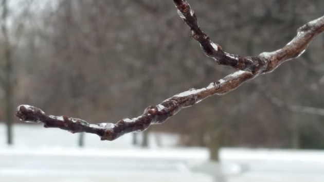
The National Weather Service has issued a freezing rain advisory for this morning until 11 am for Warren county and further to the north. Hunterdon is not in the advisory area.

We are right around freezing and some very light rain is moving east from central PA this morning. This is response to some warmer weather that will arrive overnight into Tuesday. I do not expect this to be a big issue. If you are out and about when the rain starts, just be careful if the temperature is not yet above freezing. Then we turn more seasonable the rest of the week.

SUSSEX-WARREN-MORRIS-
INCLUDING THE CITIES OF...NEWTON...WASHINGTON...MORRISTOWN
340 AM EST MON DEC 26 2016

...FREEZING RAIN ADVISORY REMAINS IN EFFECT FROM 7 AM THIS MORNING TO 1 PM EST THIS AFTERNOON...

* LOCATIONS...FAR NORTHWESTERN NEW JERSEY.

* HAZARD TYPES...LIGHT FREEZING RAIN OR FREEZING DRIZZLE.

* ICE ACCUMULATIONS...A LIGHT GLAZE IS POSSIBLE.

* TIMING...AREAS OF FREEZING DRIZZLE OR LIGHT FREEZING RAIN SHOULD  DEVELOP THIS MORNING... THEN END BY EARLY AFTERNOON AS  TEMPERATURES
  SLOWLY RISE.

* IMPACTS...ICING MAY CREATE SLIPPERY CONDITIONS, ESPECIALLY ON  UNTREATED SURFACES.

* TEMPERATURES...IN THE LOWER 30S. TEMPERATURES RISING THROUGH THE  30S THIS AFTERNOON.

PRECAUTIONARY/PREPAREDNESS ACTIONS...

A FREEZING RAIN ADVISORY MEANS THAT PERIODS OF FREEZING RAIN OR FREEZING DRIZZLE WILL CAUSE TRAVEL DIFFICULTIES. BE PREPARED FOR
SLIPPERY ROADS. SLOW DOWN AND USE CAUTION WHILE DRIVING.


05. December 2016 · Comments Off on First Snow of December · Categories: Fall, snow · Tags: , , ,

20161205_074057

The first snow of December is in the books. This is our second snowfall of the fall. 1/2″ was recorded in Stewartsville, NJ. I’ve seen reports of as much as 1.5″ in High Point NJ.

Take a picture if you like snow on the ground becasue it won’t last long. Rain returns later Tuesday into Wednesday morning. Then colder air arrives later in the week.

02. January 2016 · Comments Off on Stewartsville December 2015 Summary · Categories: Monthly Summary · Tags: , , ,

December 2015 is in the books. It was a warm month to say the least. Never seen the grass so green into the end of the month! Bulbs starting to peek through the mulch! But January looks to get back on track.

Dec2015Summary

01. December 2015 · Comments Off on More Rain on the Way · Categories: Fall, precipitation, weather discussion, weather forecast · Tags: , ,

Radar20151201-1129

As can see in the radar image above western New Jersey is about to get into an area of more steady rain. So far about 1/4″ has fallen.

12316176_1178712312158356_7556295048396052527_n

Before all is said and done we will receive about 1″ of rain through Wednesday evening. Some areas may receive a bit more.

30. November 2015 · Comments Off on Unsettled Week Ahead · Categories: Fall, weather discussion, weather forecast · Tags: , , ,

Today western New Jersey will see a gradual increase and thickening of clouds across the area. Temperatures will be cool but seasonable. Tonight if some of the rain comes in fast enough, some section further to the north and the west might actually be cold enough for some freezing rain or sleet at the onset of the storm. Please be mindful of this. I will try and post updates if it looks to be more widespread. Right now it looks like the exception instead of the rule – only in those areas to the N & W that usually get colder than surrounding areas.

12294728_1177731442256443_6355680505215739817_n

Rain will continue off and on Tuesday into Wednesday. Right now we looking at 1/2 to perhaps 1″ of rain for the area. I’ll update this if needed.

7day

01. January 2015 · Comments Off on December 2014 Weather Summary · Categories: Monthly Summary · Tags: , ,
Dec-14
DAY MAX MIN MEAN PRECIP SNOW SOG COMMENTS
1 60.0 34.0 47.0 T   1  
2 42.0 31.0 36.5 0.26 T   light snow to rain
3 44.0 35.0 39.5 0.16      
4 44.0 30.0 37.0        
5 40.0 25.0 32.5 0.26      
6 45.0 35.0 40.0 0.66      
7 45.0 26.0 35.5        
8 34.0 19.0 26.5        
9 42.0 32.0 37.0 0.72      
10 42.0 30.0 36.0 0.07 0.7    
11 35.0 29.0 32.0 0.11 1.1 0.6 snow squall
12 39.0 31.0 35.0     1.1  
13 42.0 33.0 37.5     T  
14 47.0 36.0 41.5 0      
15 47.0 30.0 38.5 0    
16 48.0 31.0 39.5 0.08      
17 51.0 36.0 43.5 0.02      
18 41.0 33.0 37.0 0      
19 38.0 31.0 34.5 0      
20 35.0 30.0 32.5 0      
21 37.0 30.0 33.5 0      
22 41.0 32.0 36.5 0.02      
23 48.0 38.0 43.0 0.13      
24 62.0 45.0 53.5 0.81      
25 64.0 39.0 51.5 0.02      
26 49.0 31.0 40.0 0      
27 56.0 30.0 43.0 0      
28 54.0 40.0 47.0 0.06      
29 44.0 26.0 35.0 0      
30 35.0 23.0 29.0 0      
31 32.0 20.0 26.0 0      
3.38 1.80
7.50 Season Total
Extreme High 64.0 Date: 12/25/2015
Extreme Low 19.0 Date: 12/8/2015
Mean Max: 44.6
Mean Low: 31.3
Mean: 38.0
29. December 2014 · Comments Off on End Of Year Weather · Categories: weather discussion · Tags: ,

After a few days off, we return to more seasonable weather. Highs will be in the30’s to near 40. New Year’s Eve will be colder with lows in the 20’s for any revelers. The next chance of precipitation will be Friday night into Saturday morning. If the precipitation arrives earlier enough it could be frozen but has the potential to go over to plain rain.

13. December 2014 · Comments Off on Nice December Weekend Weather · Categories: weather discussion · Tags:

Weather today and tomorrow will be ideal for Christmas shopping, parties and all the normal running around that goes with this time of year. Today will start off cloudy but should have more breaks of sun as the day wears on. Highs will be in the 30’s.

Tonight will be another chilly December evening with partly cloudy skies.

Sunday will feature more sunshine with high’s perhaps in the low 40’s.

So it’s a nice weekend to start/finish shopping, decorate outdoors and enjoy the season!

Animated Social Media Icons by Acurax Wordpress Development Company
Visit Us On TwitterVisit Us On FacebookVisit Us On PinterestVisit Us On YoutubeVisit Us On Instagram