
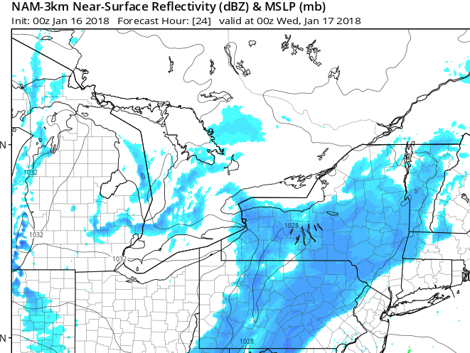
One computer model suggesting steady snow does not move into western NJ until evening
Last post of this evening. Looking at some data that suggests only flurries or very light snow for western New Jersey tomorrow during the day with the steadier snow holding off until evening/overnight on Tuesday into Wednesday. Further to the west in PA they will see some light snow during the day.
If this verifies, it reduces the chance of schools closing early but might still result in any evening activities being cancelled and certainly a delay on Wednesday morning


Recent Comments