
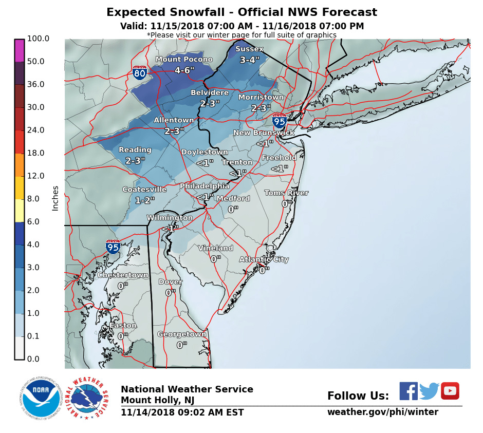
NWS snow forecast for Thursday
Many computer models and other sources of information used to make weather forecasts have trended colder for tomorrow’s storm. The high pressure system to the north that will develop today will be stronger than originally thought. As a result today we will not see temperatures go up that much from where there are now despite sunshine. Tonight will be the coldest night of the new cold season.
As a result I’m increasing my snow forecast for tomorrow to a coating to 2″ with more to the north. The snow will still mix with and change to sleet/freezing rain and then rain my Thursday evening. The devil is in the details as they say as to when this happens. Most of the time for for I-78 corridor this happens sooner than anticipated. I’m counting on that to happen again this time hence why my snow totals are lower than the NWS map above. But of course the potential is there to receive more.
Recent Comments