
NWS snow forecast
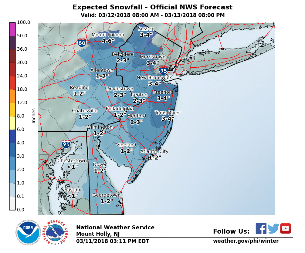
Sunday night will be a cold night with low temperatures near 20 which is colder than the last few nights. Monday will feature increasing clouds and continued cool with night in the mid to upper 30’s. Normal high this time of year is 47. Light snow should start to move into western New Jersey from SW to NE in the evening around 8 pm give or take. Periods of light snow should continue overnight and end Tuesday morning. At this time I’m forecasting a coating to 2″ for most locations of western New Jersey. There will be more snow from this storm to the north and east. Here is a forecast map wider in scope:

Recent Comments