
Initial NWS snow forecast for Tuesday
Let me start off by saying the next storm, which is now a Monday night into Tuesday time frame, has always been forecast to occur. For the past couple of days it’s influence looks to stay to our south and east. The past couple of computer runs are now suggesting it may travel a little closer to our area.
Even if this didn’t happen, there were indications there was going to be a little light snow with this event from an upper level low pressure system that was going to pass overhead Tuesday into Wednesday.
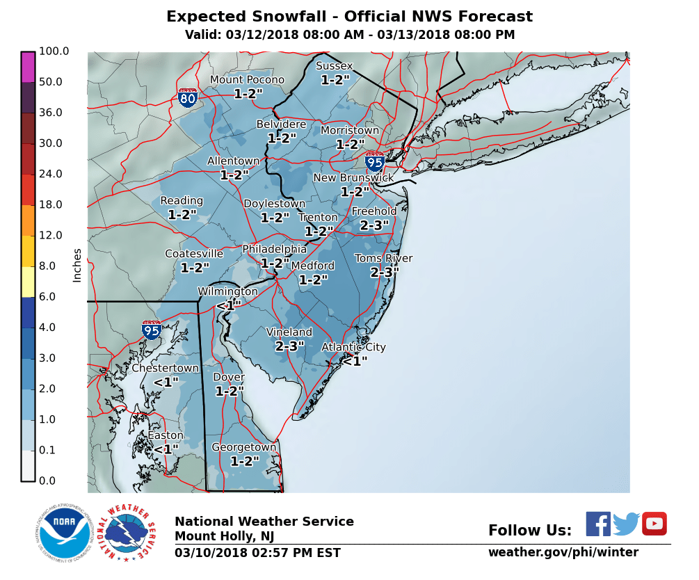
Right now the above map is a good starting point for any snow accumulations in our area. If we truly only get a few inches, it will primarily only accumulate on colder surfaces and not roads. Unfortunately trees are colder surfaces and many of them are weak from the last 2 storms and could result in some power outages but let’s hope that is at a minimum and some people are STILL without power from the FIRST storm.
The things to keep an eye on now is the trend. If the computer model keep the trend closer to us then we can plan accordingly.
Also note the more snow will fall further to the east and south of western New Jersey as it looks at this time.
Regardless this will be another nor’easter storm that will have big impacts to eastern New England. The pattern of strong storms does look to end with this one for now.
Recent Comments