16. August 2016 · Comments Off on Severe Thunderstorm Watch until 11 pm · Categories: Summer, thunderstorms · Tags:
Severe thunderstorm watch for western NJ

Severe thunderstorm watch for western NJ

The NWS Storm Prediction Center has issued a

* Severe Thunderstorm Watch for portions of 
  District of Columbia
  northern Delaware
  much of Maryland
  New Jersey
  eastern Pennsylvania
  northern Virginia
  coastal waters

* effective this Tuesday afternoon and evening from 320 PM until
  1100 PM EDT.

* Primary threats include...
  isolated damaging wind gusts to 70 mph possible
  isolated large hail events to 1.5 inches in diameter possible

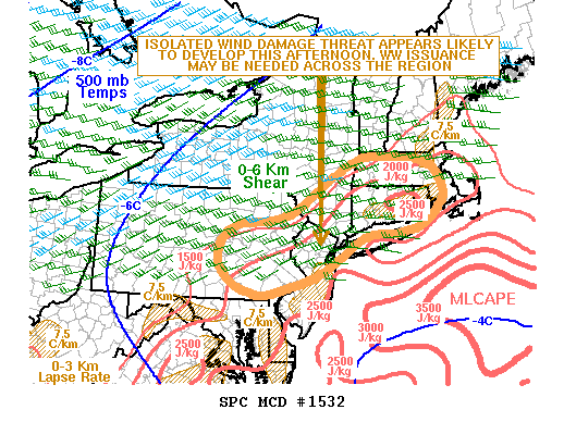
Summary...north-south squall line is gradually intensifying over
central Pennsylvania into western Maryland.  Damaging winds can be
expected with this line of convection as it spreads toward New
Jersey.

The Severe Thunderstorm Watch area is approximately along and 70
statute miles east and west of a line from 25 miles south
southwest of Baltimore Maryland to 40 miles north of Allentown
Pennsylvania.  For a complete depiction of the watch see the
associated watch outline update (wous64 kwns wou7).

Precautionary/preparedness actions...

Remember...a Severe Thunderstorm Watch means conditions are
favorable for severe thunderstorms in and close to the watch
area. Persons in these areas should be on the lookout for
threatening weather conditions and listen for later statements
and possible warnings. Severe thunderstorms can and occasionally
do produce tornadoes.


Aviation...a few severe thunderstorms with hail surface and aloft
to 1.5 inches. Extreme turbulence and surface wind gusts to 60
knots. A few cumulonimbi with maximum tops to 500. Mean storm
motion vector 25030.
16. August 2016 · Comments Off on Severe Weather Risk Continues For Tuesday · Categories: Summer, thunderstorms · Tags:
SPC maintains a slight risk of severe weather on Tuesday for western New Jersey

SPC maintains a slight risk of severe weather on Tuesday for western New Jersey

Best time for this to happen, if it does, is 3 pm onward today. This may not be widespread.

Radar is not showing too much now…

15. August 2016 · Comments Off on Severe Thunderstorms Possible Tuesday · Categories: Summer, thunderstorms · Tags:
Slight risk of severe thunderstorms possible on Tuesday

Slight risk of severe thunderstorms possible on Tuesday

Keep an eye to the sky on Tuesday. Any thunderstorms that do form in western New Jersey have the potential to be slightly more severe than normal

14. August 2016 · Comments Off on Severe Thunderstorms Possible This Evening · Categories: Summer, thunderstorms · Tags:
SPC has upgraded western NJ to a slight risk of severe thunderstorms this afternoon and evening

SPC has upgraded western NJ to a slight risk of severe thunderstorms this afternoon and evening

mcd1532

14. August 2016 · Comments Off on Electrifying Evening · Categories: Summer, thunderstorms · Tags:
Lightening photos August 13, 2016 from Stewartsville, NJ

Lightning photos August 13, 2016 from Stewartsville, NJ

Unless you were out of town last night, you couldn’t but help notice the thunderstorms that passed into western New Jersey last evening. I was able to get a few descent photos of the lightning since the storms were not directly overhead where I was. All photos © 2016 Dave Dabour, Dabour Photography

Lightening20160814-Dabour-036 Lightening20160814-Dabour-094

12. August 2016 · Comments Off on Excessive Heat Warning Continues For Western New Jersey… · Categories: Summer · Tags:
...Excessive heat warning remains in effect from noon Saturday to
9 PM EDT Sunday...
...Heat advisory will expire at 8 PM EDT this evening...

* maximum heat index values...105 to 110 on Saturday afternoon
  and 102 to 107 on Sunday afternoon.

* Temperatures...highs are forecast to be in the middle 90s on
  Saturday and in the lower to middle 90s on Sunday. Overnight
  lows are expected to favor the middle and upper 70s.

* Timing...heat index values will reach excessive levels during
  the afternoon and early evening hours each day. Scattered
  showers and thunderstorms may bring brief periods of relief from
  the heat.

* Impacts...the multiple day excessive heat will increase the
  risk for heat-related health issues...especially for the elderly
  and for those with chronic health problems such as lung and
  heart disease.

* Outlook...a frontal boundary approaching from the northwest
  should arrive early in the new week bringing some relief from
  the oppressive heat and humidity.

Precautionary/preparedness actions...

This excessive heat warning means that a prolonged period of
dangerously hot temperatures and high humidity levels will occur.
The conditions will enhance the potential for the development of
heat-related health issues among susceptible individuals. Be sure
to drink plenty of fluids...stay in an air- conditioned
environment if possible...stay out of the sun and check on elderly
relatives and neighbors.

Children and pets should never be left unattended in a vehicle
under any circumstance. During hot weather a car interior can
reach lethal temperatures in a matter of minutes.

Take extra precautions if you work or spend time outside. When
possible...reschedule strenuous activities to the early morning or
late evening. Know the signs and symptoms of heat exhaustion and
heat stroke. Wear light weight and loose fitting clothing and
drink plenty of water.

To reduce risk during outdoor work...the occupational safety and
health administration recommends scheduling frequent rest breaks
in a shaded or air conditioned environment. Anyone overcome by
heat should be moved to a cool shaded location. Heat stroke is an
emergency...call 9 1 1.
06. August 2016 · Comments Off on Thundershowers Entering The Area · Categories: Summer, thunderstorms · Tags:
20160806_152031
...A line of strong thunderstorms will affect Warren...northern
Hunterdon...Sussex...northwestern Somerset...Morris...Northampton...
southeastern Monroe and southeastern Carbon counties...

At 249 PM EDT...a line of strong thunderstorms was along a line
extending from near West Milford to near Newton to near Belvidere to
near Kunkletown...and moving east at 30 mph.

Wind gusts up to 40 mph are possible with these storms.

Locations impacted include...
Easton...Morristown...Newton...Dover...Madison...Hopatcong...Forks...
East Hanover...Lincoln Park...Kinnelon...Hackettstown...Boonton...
Wilson...Butler...Wharton...Washington...Rockaway...Blairstown...
Nazareth and Morris Plains.

These storms may intensify...so be certain to monitor local radio and
TV stations...as well as local cable TV outlets...for additional
information and possible warnings from the National Weather Service.
27. July 2016 · Comments Off on Flash Flood Watch Thursday late into Friday · Categories: Flash Floods, Summer, thunderstorms · Tags:

So as usual, we go from hardly any rain at all to a whole bunch. The next system looks to deposit 1-1.5″ of rain to western New Jersey later Thursday into Friday.

I’ll post updates tomorrow.

...Flash Flood Watch in effect from Thursday evening through
Friday evening...

The National Weather Service in Mount Holly has issued a

* Flash Flood Watch for portions of Delaware...northeast 
  Maryland...New Jersey and southeast Pennsylvania...including 
  the following areas...in Delaware...Delaware beaches...inland 
  Sussex...Kent and New Castle. In northeast Maryland... 
  Caroline...Cecil...Kent MD...Queen Annes and Talbot. In New 
  Jersey...Atlantic...Atlantic coastal Cape May...Camden...Cape 
  May...coastal ocean...Cumberland...eastern Monmouth... 
  Gloucester...Hunterdon...Mercer...Middlesex...northwestern 
  Burlington...ocean...Salem...Somerset...southeastern 
  Burlington and western Monmouth. In southeast Pennsylvania... 
  Delaware...eastern Chester...eastern Montgomery...lower 
  Bucks...Philadelphia...upper Bucks...western Chester and 
  western Montgomery. 

* From Thursday evening through Friday evening

* periods of showers and embedded thunderstorms are expected
  Thursday night into Friday. Some of the thunderstorms may
  contain torrential rainfall and result in a localized flash
  flood threat. 

* The axis of heaviest rain remains uncertain at this time.
  However, the potential for localized rainfall amounts of 2 or
  more inches in one hour will bring the risk for flash flooding
  particularly in urban areas.

Precautionary/preparedness actions...

A Flash Flood Watch means that conditions may develop that lead
to flash flooding. Flash flooding is a very dangerous situation.

You should monitor later forecasts and be prepared to take action
should flash flood warnings be issued.
27. July 2016 · Comments Off on Time lapse video of July 25th thunderstorms passing through · Categories: Summer, thunderstorms · Tags:

25. July 2016 · Comments Off on Severe Thunderstorm Warning for Warren County · Categories: Summer, thunderstorms, weather discussion · Tags: ,

Radar-20160725-1600NJ_swody1 (1)


Update: The Storms Prediction Center is upgrading our area to enhanced risk of severe thunderstorms…


Animated Social Media Icons by Acurax Wordpress Development Company
Visit Us On TwitterVisit Us On FacebookVisit Us On PinterestVisit Us On YoutubeVisit Us On Instagram