

Above is the latest forecast on major Hurricane Matthew as of 8 am from the National Hurricane Center. Things to note since my last posting:
- Matthew became a category 5 hurricane – the strongest level on a scale of 1 to 5. It has weakened slightly since then but still a major hurricane (major hurricane = 3 or higher on the scale based on wind speeds)
- The forecast path of Matthew has slowed down by the NHC as seen above. It will only be of the Georgia coast by 2 am Saturday. Clouds and rain will be further north. A slow moving hurricane, while it might be good for the US in this case, is not good for where the hurricane is impacting. Slower = more time for devastating winds and rains
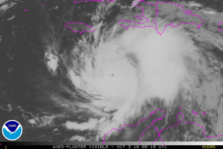
Above is a current satellite loop of the hurricane. The eye is still visible.

Where does Matthew go from here? The official NHC track is the darker line. At this time it looks to move north towards the outer banks of North Carolina and then get pushed further to the NE from an approaching cold front later this week into the weekend. As of right now this forecast looks good. But hurricanes can have a mind of their own. As you can see above, there a few models that bring him very close to western new jersey area! Continue to stay current on the storm.
Recent Comments