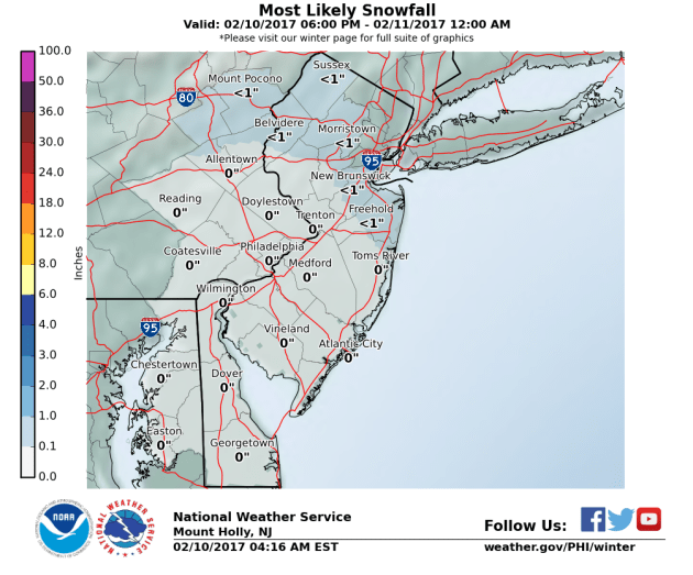
A fast moving “clipper” storm system will be moving through the northern sections of western New Jersey later this evening into early Saturday morning. It has the potential to leave a coasting perhaps up to 1″ in the higher elevations of northern sections. This will primarily be north of I-80 event. But I’m mentioning it in case a few snow showers make their way further south. As you can see in the above map it will have a NW to SE flow to the light precipitation.
On Sunday another system approaches up but we will be warm enough for some light rain. It may end as a little wet snow on Sunday night but should amount to much for us. Boston on the other hand looks to get hit again from the Sunday system on Monday for them. Some Bostonian’s may be getting a 5 day weekend!
Long range we need to keep our eyes on Thursday and next weekend.


Recent Comments